How Valley streets
got their names.
Where the address grid starts, who the big roads are named for, why the freeways carry the names they do, and the mountains and canals behind them. Every answer comes from the city, ADOT, SRP or the county.

One survey line, two zero streets
Baseline Road follows the baseline of the Gila and Salt River survey. Its initial point, a monument set by the 1851 boundary survey, was chosen in 1865, and the first survey from it ran in 1867. That survey line is what the Valley's street grid was built from.
In Phoenix, addresses start at Central Avenue and Washington Street and count up in every direction. Central is the dividing line: east of it, north-south roads are Streets, then Places and Ways; west of it they are Avenues, then Drives and Lanes. So 7th Street and 7th Avenue are about one mile apart.
Phoenix's first names
Central Avenue was Centre Street. The other north-south streets were named for local tribes and the east-west streets for U.S. presidents, starting with Washington. The tribal names gave way to numbers in the 1890s. A Common Council resolution on October 6, 1902 then renamed subdivision streets to fit the numbered avenues and streets.
Mesa counts on its own
Mesa's zero lines are Center Street and Main Street. Each hundred block is 660 feet, an eighth of a mile. East-west roads north of Main are Streets and those south of Main are Avenues.
Tempe spells it out
Rio Salado Parkway is Tempe's north-south divider and Mill Avenue its east-west divider. Tempe spells out its numbered streets, First Street and Second Street, counting south from Rio Salado.
Downtown Buckeye
Most of Buckeye counts from Washington Street and Central Avenue in Phoenix. Downtown Buckeye is the exception and starts from Monroe Avenue and 1st Street.
Downtown Phoenix had names first
The original townsite named its north-south streets for local tribes and for Cortes and Montezuma, and its east-west streets for U.S. presidents. Washington Street sat in the middle, with Adams the first street north and Jefferson the first street south. The city later traded the names for numbers, which were easier to remember.
Central Avenue
Centre Street.
1st Avenue
Cortes.
2nd Avenue
Mohave.
1st Street
Montezuma.
2nd Street
Maricopa.
3rd Street
Pima.
4th Street
Pinal.
18th Avenue
Western Avenue.
The long roads and their names
These roads cross several cities. ADOT traced the names of the major cross streets along each freeway.
McDowell Road
Named for Civil War General Irvin McDowell. Camp McDowell and Fort McDowell carry his name too.
Thomas Road
Named for William E. Thomas, Arizona's Territorial Deputy County Recorder in the early 1900s.
Indian School Road
Named for the Phoenix Indian School, which opened in the 1890s.
Camelback Road
Named for Camelback Mountain.
Shea Boulevard and Bell Road
James A. Shea and Harvey Bell were farmers and homesteaders who helped form the Paradise Verde Irrigation District. Their story is further down this page.
Broadway Road
Named for Noah M. Broadway, Maricopa County sheriff in 1885 and 1886. Not the street in New York.
McKellips Road
Named for Gordon W. McKellips, a businessman and land and citrus developer in the Valley.
Grand Avenue
The Arizona Canal company built it in 1887 as a wide boulevard from Phoenix to the northwest, and laid out Alhambra, Glendale and Peoria along it.
Northern Avenue
Named for sitting at the northern edge of the Salt River Valley.
Van Buren, Adams and Jefferson
Named for presidents Martin Van Buren, John Adams and Thomas Jefferson. Downtown Phoenix's east-west streets were named for U.S. presidents, starting with Washington.
Grant Street
Named for Ulysses S. Grant, the 18th president.
Buckeye Road
Named for the city of Buckeye, which takes its name from the Buckeye Canal. Founder M.M. Jackson named the canal for his home state of Ohio.
A chaplain, a farmer and a colonel
McClintock Drive and Hayden Road are the same north-south road. In Tempe it is McClintock Drive; at McKellips Road, on the Tempe and Scottsdale line, it becomes Hayden Road. In Tempe, Hayden Road ran south to University Drive until 1991, when that stretch became McClintock Drive, named for Col. James H. McClintock. The Hayden name comes from Wilford Hayden, who farmed in the Scottsdale area, not from Tempe founder Charles Trumbull Hayden.
Scottsdale Road
Named for the city, which former U.S. Army chaplain Winfield Scott founded in the late 1800s.
Tatum Boulevard
Named for Russell F. Tatum, the first mayor of Homestead, Florida, whose family moved to Arizona in the 1920s and worked in real estate and land development.
Chaparral, Pima and Princess
The City of Scottsdale picked the name Chaparral Road in the 1960s. Pima Road is named for the Salt River Pima-Maricopa Indian Community, and Princess Drive for the Fairmont Scottsdale Princess hotel.
Priest Drive
Named for James T. Priest, a Canadian pioneer rancher who settled in the Tempe area in the early 1870s.
Rural Road
Named for the Rural School, a schoolhouse that stood at the northeast corner of Rural Road and Southern Avenue.
Mill Avenue
The name points to the Hayden Flour Mill at the north end of downtown Tempe.
McDonald Drive
Originally MacDonald Drive, for Duncan MacDonald, a pioneer builder and contractor in the Valley.
Indian Bend Road
Named for a nearby wash.
Frank Lloyd Wright Boulevard
Named for the architect. Taliesin West, nearby, was his winter home for decades.
Talking Stick Way
Leads to Talking Stick Resort.
University Drive
Runs through Arizona State University in Tempe.
Rio Salado Parkway
Rio Salado is Spanish for Salt River.
Apache Boulevard
East 13th Street until 1950, when Tempe renamed it.
Kyrene Road
The Tempe History Museum says the name very likely came from the ancient city of Cyrene in Libya or Kyrenia on Cyprus.
Who Wilford Hayden was
The Arizona Farm and Ranch Hall of Fame says Wilford Hayden came to the Arizona Territory from Missouri in 1886 and farmed south of today's Sky Harbor until the 1891 flood washed him out. He moved to Scottsdale, north of McDowell and east of Scottsdale Road, and the dirt road out to his 240-acre farm was named Hayden Road. He grew cotton and alfalfa, raised pigs and ran a dairy. The City of Scottsdale says he and E.O. Brown first ranched the land at today's Browns Ranch in the McDowell Sonoran Preserve.
Founders, ranchers and a country club
Country Club Drive in Mesa and Arizona Avenue in Chandler are the same road.
Country Club Drive
Named for the Mesa Country Club, which opened in 1948. The street went by other names before that, including Crismon Street and Mesa Blvd.
Stapley Drive
Named for O.S. Stapley, a Mesa businessman who owned a hardware and farm supply business.
Chandler Boulevard
Named for Dr. A.J. Chandler, who founded the Chandler town site in 1912 and was the first veterinary surgeon for the territory of Arizona.
Price Road
Named for Arthur Price, the local Justice of the Peace who drafted Chandler's first town charter.
Gilbert Road
Named for William "Bobby" Gilbert, who sold the railroad a right-of-way through his land in 1902.
Val Vista Drive
Called Reebes until 1959. It was likely renamed for the nearby Val Vista Citrus Groves.
Power Road
Named for James and Sarah Power, who raised cattle and crops in Higley.
Ellsworth Road
Named for Leo Ellsworth, a businessman who helped build many of Queen Creek's roads in the 1920s and 1930s.
Crismon Road
Named for the Crismon family, the first settlers of what was then called Lehi, in 1878.
Dobson Road
Named for Cliff Dobson, who co-owned the Baseline Cattle Company.
Alma School Road
Named for an old schoolhouse on the east side of the road.
Mesa Drive
Named for the city.
Higley Road
Named for Stephen Weaver Higley, who is credited with building the Santa Fe line between Arizona and California.
Sossaman Road
Named for the Sossaman family, whose farm ran over 1,000 acres.
Ray Road
Named for Milton and Gwen Ray. Milton's family farmed between Gilbert and Cooper roads.
Warner Road
Named for Samuel and Lydia Warner. Samuel served on the Kyrene school board from 1916 to 1919.
Elliot Road
Named for the Elliot family, who owned land in the area.
A mine, a ballclub and an airfield
Glendale started as a temperance colony in the 1800s, and Peoria was settled by families from Peoria, Illinois. Both cities gave their names to avenues.
Thunderbird Road
Named for a nearby World War II training field for Allied pilots.
Cardinals Way
Named for the Arizona Cardinals, who play nearby. It replaced Bethany Home Road, which was named for a Central Phoenix sanatorium.
Union Hills Drive
Named for the Union Mine, a gold mine in Yavapai County.
Cactus Road
Named for the town of Cactus, which sat northeast of Sunnyslope.
Mayors, sanatoriums and a golf course
Bethany Home Road
Named for the Bethany Home, a tuberculosis sanatorium in the early 1900s.
Dunlap Avenue
Named for John T. Dunlap, mayor of Phoenix from 1904 to 1905.
Greenway Road
Named for John Greenway, an Arizona pioneer who fought in the Spanish-American War.
Pinnacle Peak Road
Named for nearby Pinnacle Peak.
Jomax Road
Named for sisters Josephine and Maxine Durham. The road led to Maxine's golf course.
Carefree Highway
Named for the Carefree Development Corporation, which founded the Town of Carefree.
Nisbet Road
Named for the Nisbet family, who gave 2.5 acres for a school in 1930.
Two farmers and a canal that never ran
Shea Boulevard and Bell Road carry the names of James A. Shea and Harvey Bell, farmers and homesteaders who helped form the Paradise Verde Irrigation District. Settlers in Paradise and Deer valleys organized to bring water to land north of the Arizona Canal.
A 1918 district map shows a planned canal along what is now North 32nd Street. No water ever flowed in it, and the district had failed by 1933. It had held a permit to begin a dam at the Horseshoe site on the Verde River but could not sell its bonds. Horseshoe Dam was built from 1944 to 1946 by Phelps Dodge for the Salt River Valley Water Users' Association. The farmers' names stayed on the roads.
Four of the faces behind the names
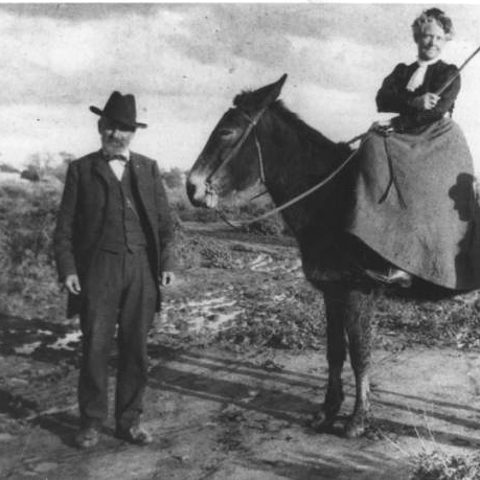
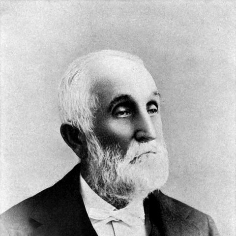
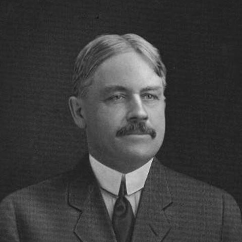
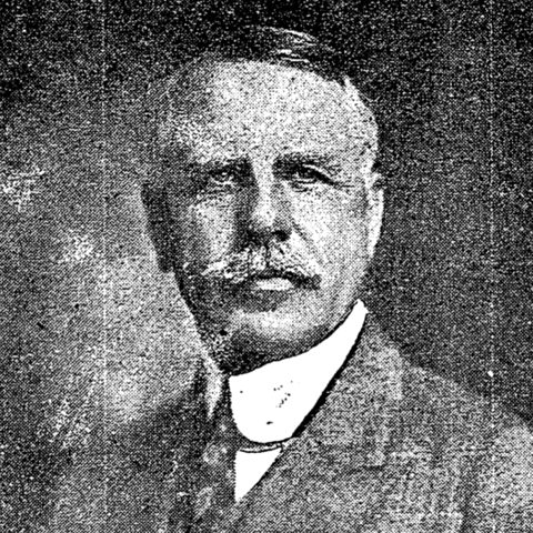
Where the city names came from
Scottsdale's first 640 acres sat inside what are now Indian School, Scottsdale, Chaparral and Hayden roads.
Phoenix
Darrell Duppa suggested the name because the new town rose from the ruins of an older civilization.
Tempe
Duppa named it in 1879. The area reminded him of the Vale of Tempe in ancient Greece.
Gilbert
A rail siding was set on land owned by William "Bobby" Gilbert, and the town took his name.
Peoria
The founders came from Peoria, Illinois and named the settlement after their hometown in the 1897 plat.
Paradise Valley
Surveyors for the Rio Verde Canal Company named it in 1889.
Why the freeways carry those names
SR 51, Piestewa Freeway
Named for Army Specialist Lori Piestewa, a member of the Hopi Tribe killed in the 2003 invasion of Iraq. The freeway runs past Piestewa Peak, also named in her honor.
I-10
In the Valley, one stretch is the Papago Freeway and another the Maricopa Freeway. Outside the Valley it is the Pearl Harbor Memorial Highway, a legislative designation from 1995.
I-17
The 140 miles between Flagstaff and the Valley are the Arizona Veterans Highway, from a 2004 resolution.
Loop 202 Red Mountain
Originally named the East Papago Freeway. It opened in 1993 and was completed in 2008.
SR 87, the Beeline
It became the Beeline Highway in 1959 because it makes a beeline for the high country of Payson. In 1996 the stretch between the Valley and Payson was named the Duthie-Martin Highway for Arizona DPS officers Gilbert Duthie and Robert Martin, who died in the line of duty on that road.
The peaks behind the names
Piestewa Peak
Formerly Squaw Peak. The U.S. Board on Geographic Names formally approved the name Piestewa Peak in 2008. The peak is 2,608 feet and part of the Phoenix Mountains Preserve.
Camelback Mountain
Private building pushed up the mountain until the 1960s. The Preservation of Camelback Mountain Foundation, led by Barry Goldwater, helped secure its protection in 1968.
Hayden Butte
Named for Charles Trumbull Hayden, often credited as Tempe's founder. The first "A" was laid in loose rock in 1938.
Mummy Mountain
Longtime resident Charlie Mieg named it, looking for a name with more marketing appeal. He thought it looked like an Egyptian mummy lying down.
Paradise Valley
In 1889 surveyors for the Rio Verde Canal Company were so taken with the landscape that they named it Paradise Valley.
Usery Mountain
Named for King Usery, a cattleman in the area in the late 1870s and early 1880s. King was his first name, not a title.
White Tank Mountains
Flash floods carved depressions, or tanks, into the white granite.
The water the streets followed
Ancestors of today's Salt River Pima-Maricopa and Gila River Indian communities farmed here for about 1,400 years, with a canal system of nearly 500 miles. They stopped maintaining the canals around A.D. 1450.
Swilling Ditch
Dug by the Swilling Irrigation and Canal Company, formed in December 1867. The first crops came in by March 1868.
Tempe Canal, 1871
The oldest canal still in continuous use in SRP's system.
Grand Canal, 1878
The oldest remaining pioneer canal on the north side of the Salt River.
Arizona Canal, 1885
Built from 1883 to 1885. At more than 38 miles it is the longest canal in SRP's system. Winfield Scott, who founded Scottsdale, homesteaded next to it in 1888.
Consolidated Canal, 1891
Dr. A.J. Chandler's Consolidated Canal Company started it to bring water to the land that now bears his name.
On the banks today
SRP says its canal banks are for walking, jogging and biking. Swimming, tubing and boating are not allowed, and motorized vehicles, including e-bikes and scooters, are not allowed on the banks.
Valley street names, answered
Where does the Phoenix address grid start?
At Central Avenue and Washington Street. Addresses count up from those two zero lines in every direction.
What is the difference between a Street and an Avenue in Phoenix?
Central Avenue is the dividing line. East of Central, north-south roads are Streets; west of Central they are Avenues. 7th Street and 7th Avenue are about one mile apart.
Why is it called Baseline Road?
It follows the baseline of the Gila and Salt River survey, whose initial point was chosen in 1865, the line the Valley's street grid was built from.
Does McClintock Drive turn into Hayden Road?
Yes. At McKellips Road, on the Tempe and Scottsdale line, McClintock Drive becomes Hayden Road. Tempe renamed its stretch for Col. James H. McClintock in 1991.
Is Arizona Avenue the same road as Country Club Drive?
Yes. Arizona Avenue in Chandler becomes Country Club Drive in Mesa.
Who is Bell Road named for?
Harvey Bell, a farmer who helped organize the Paradise Verde Irrigation District in 1916.
Why is SR 87 called the Beeline Highway?
It became the Beeline Highway in 1959 because it makes a beeline for the high country of Payson.
What was Piestewa Peak called before?
Squaw Peak. The U.S. Board on Geographic Names formally approved the name Piestewa Peak in 2008.
What was the Red Mountain Freeway first called?
The East Papago Freeway.
What were Phoenix streets called before they had numbers?
The north-south streets were named for local tribes and for Cortes and Montezuma. Central Avenue was Centre Street, 1st Avenue was Cortes and 1st Street was Montezuma.
Who is Shea Boulevard named for?
James A. Shea, a farmer and homesteader who helped form the Paradise Verde Irrigation District.
Why is it called Bethany Home Road?
It is named for the Bethany Home, a tuberculosis sanatorium in the early 1900s.
Who is Dobson Road named for?
Cliff Dobson, who co-owned the Baseline Cattle Company.
How did Tempe get its name?
Darrell Duppa named it in 1879 because the area reminded him of the Vale of Tempe in ancient Greece.
More on each city page
Each city page carries these answers for its own streets, canals and landmarks, with the market numbers, taxes and utilities.
Know the street. Ask about the house.
Lot, build year and anything recorded on a parcel sit in the county and city records. Send me the address and I will pull them.
Street grid and names: City of Phoenix, Phoenix Streetscapes Conservation Report and Street Naming Process.
Mountains and parks: City of Phoenix, Piestewa Peak Park building inventory, Camelback Mountain Trails, South Mountain Park/Preserve.
Canals: SRP, A history of canals in Arizona and Canal safety; City of Phoenix, Grand Canalscape and S'edav Va'aki Village history.
Freeway names: ADOT, Arizona highways honor veterans all year long.
I-10 names: ADOT, How I-10 became Pearl Harbor Memorial Highway.
SR 87: ADOT, On this day in 1996, much of SR 87 became Duthie-Martin Highway.
Scottsdale street names: ADOT, How Loop 101 Pima Freeway cross streets were named.
McClintock Drive and Hayden Road: Tempe History Museum, Tempe Place Names.
History and canal: City of Scottsdale, Scottsdale History and Arizona Canal District guidelines; SRP, A history of canals in Arizona and Canal safety.
Tempe, Mesa, Gilbert and Queen Creek street names: ADOT, How some US 60 cross streets got their names and How some Loop 101 Price Freeway cross streets got their names; Tempe History Museum, Tempe Place Names.
Hayden Butte: Tempe History Museum, Hayden Butte Preserve Park/A Mountain.
Tempe addressing: City of Tempe, street address document.
Tempe canal paths: SRP, A history of canals in Arizona and Canal safety; City of Tempe, Multi-Use Paths and Bridges.
Mesa addressing: City of Mesa, Address and Street Name Assignment Policy.
Lehi, Usery and Red Mountain: City of Mesa, Lehi Sub-Area Plan; Maricopa County Parks, Usery Mountain history; Salt River Pima-Maricopa Indian Community, About.
Red Mountain Freeway: ADOT, Construction of Loop 202 Red Mountain Freeway.
Mesa canals: SRP, A history of canals in Arizona and Canal safety; City of Mesa, Eastern Canal Shared Use Path.
Chandler canals: SRP, A history of canals in Arizona and Canal safety; City of Chandler, Paseo Trail.
Gilbert canal trails: SRP, A history of canals in Arizona and Canal safety; Town of Gilbert, Riding Gilbert's Trails.
Paradise Valley and Mummy Mountain: Town of Paradise Valley, Town History.
Glendale street names: ADOT, How some Loop 101 Agua Fria cross streets got their names.
History and trails: City of Glendale, History Walk and Grand Canal Linear Park; SRP, Canal safety.
Peoria: City of Peoria, About Peoria.
Buckeye addressing and the White Tanks: City of Buckeye, Engineering Design Standards, Addressing Procedures; White Tanks: Maricopa County Parks, White Tank Mountain Regional Park.
More street names: ADOT, How I-17 cross streets got their names.
Phoenix's original street names: City of Phoenix, City history.
Nisbet Road and the Paradise Verde canal: City of Phoenix, North 32nd Street plan.
Paradise Verde Irrigation District, Grand Avenue and Paradise Valley: SRP, The Story of SRP.
Horseshoe Dam: Bureau of Reclamation, Horseshoe Dam.
Tempe, Kyrene and Apache: Tempe History Museum, Tempe history FAQs.
Tempe's name: Tempe History Museum, How Tempe got its name.
Gilbert: Town of Gilbert, History.
Peoria: City of Peoria, Timeline 1880s to 1899.
Scottsdale's first 640 acres: City of Scottsdale, 75 years of Scottsdale history.
Chandler and Price: City of Chandler, History of Chandler.
Portraits: Winfield and Helen Scott, 1900; Charles Trumbull Hayden, 1901; James H. McClintock, about 1900 to 1909; A.J. Chandler, Arizona Republican, 1920. All public domain, via Wikimedia Commons: Scott, Hayden, McClintock, Chandler.


Added 8 November 2026: the original Phoenix street names, North Phoenix, more East Valley and Tempe roads, town names, the Shea and Bell story and the portraits.
Wilford Hayden: Arizona Farm and Ranch Museum and Hall of Fame, Paul E. Hayden and Wilford J. Hayden; City of Scottsdale, Scottsdale History, October 2024.
Photo: Arizona Canal at the 28th Avenue bridge, looking west, James Eastwood, July 1990, Historic American Engineering Record (HAER ARIZ,7-PHEN.V,1-58), public domain, via Wikimedia Commons. All sources checked 8 November 2026.